Water on Mars
Since the visits of the Mariner and Viking space probes, we have visual evidence that flowing water once modified the Martian surface.
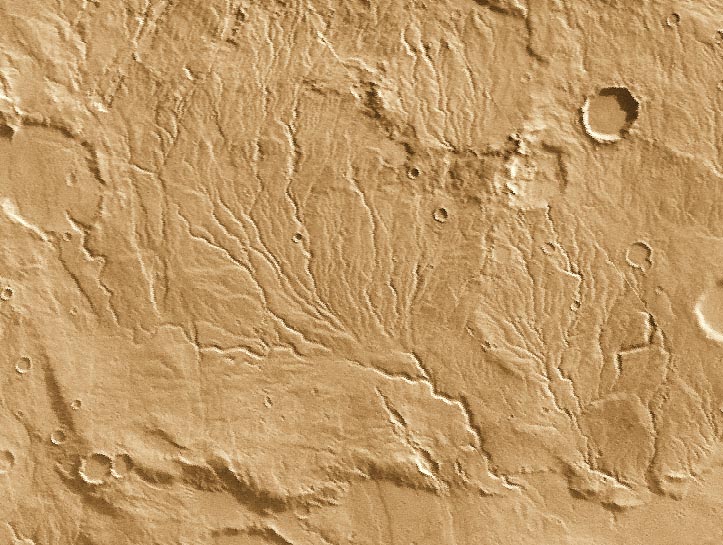
The image above, taken by the Viking orbiter, shows a resemblance to arid climate drainage systems on Earth, where water acts at slow rates over long periods of time. As on Earth, the channels shown here merge together to form larger channels. However, these valley networks are less developed than typical terrestrial drainage systems, with the Martian examples lacking small-scale streams feeding into the larger valleys. Because of the absence of small-scale streams in the Martian valley networks, it is thought that the valleys were carved primarily by ground water flow rather than by runoff of rain. Although liquid water is currently unstable on the surface of Mars, theoretical studies indicate that flowing groundwater might be able to form valley networks if the water flowed beneath a protective cover of ice. Alternatively, because the valley networks are confined to relatively old regions of Mars, their presence may indicate that Mars once possessed a warmer and wetter climate in its early history

Image shows a fluid-scoured surface in the Hrad Vallis system, located northwest of Elysium Mons. The fluid is presumed to have been water. Image PIA02076.tif, obtained by MOC on July 20, 1998.
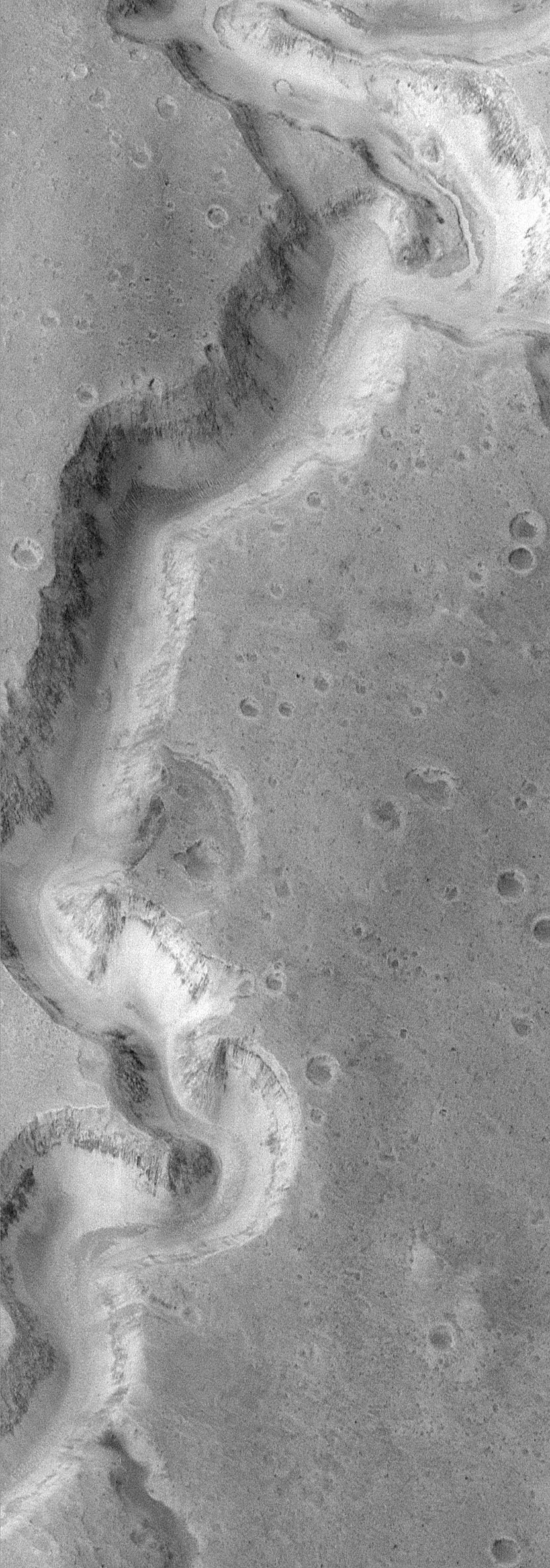
MOC image 8704 (above) shows a portion of the meandering canyons of the Nanedi Valles system--one of several valleys that cut through the smooth and cratered plains of the Xanthe Terra region of Mars. The valley is about 2.5 km (1.6 mi) wide. The floor of the valley in the upper right corner of the MOC image exhibits a small, 200 m (660 ft) wide channel that is covered by dunes and debris elsewhere on the valley floor. The presence of this channel suggests that the valley might have been carved by water that flowed through this system for an extended period of time. In other words, instead of a massive, catastrophic flood, this valley might have been incised in a manner similar to rivers on Earth. The valley itself would have widened by a variety of processes in addition to the water flowing along the bottom of the channel--slumps and landslides, wind, and perhaps groundwater flow could have all contributed to these processes. PIA02094.tif
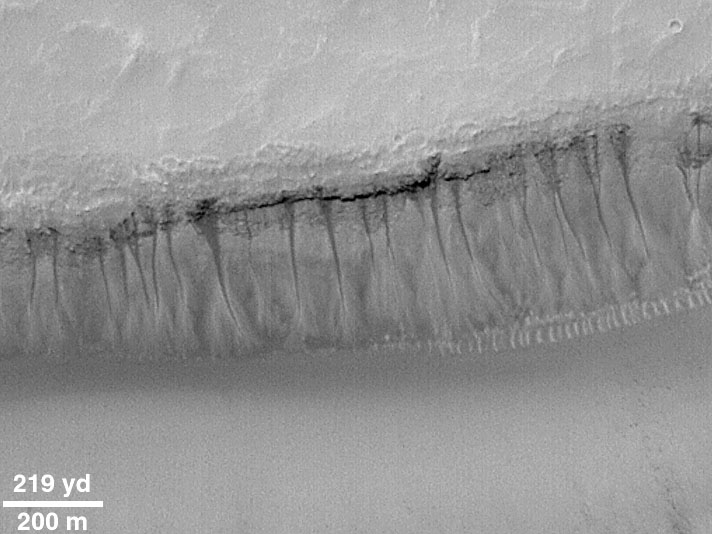
This image, acquired by the Mars Global Surveyor (MGS) Mars Orbiter Camera (MOC) in May 2000 shows numerous examples of martian gullies that all start--or head--in a specific layer roughly a hundred meters beneath the surface of Mars. These features are located on the south-facing wall of a trough in the Gorgonum Chaos region, an area found to have many examples of gullies proposed to have formed by seepage and runoff of liquid water in recent martian times. The layer from which the gullies emanate has recessed backward to form an overhang beneath a harder layer of rock. The larger gullies have formed an alcove--an area above the overhang from which debris has collapsed to leave a dark-toned scar. Below the layer of seepage is found a dark, narrow channel that runs down the slope to an apron of debris. The small, bright, parallel features at the base of the cliff at the center-right of the picture is a series of large windblown ripples. Although the dark tone of the alcoves and channels in this image is not likely to be the result of wet ground (the contrast in this image has been enhanced), it does suggest that water has seeped out of the ground and moved down the slope quite recently. Sharp contrasts between dark and light areas are hard to maintain on Mars for very long periods of time because dust tends to coat surfaces and reduce brightness differences. To keep dust from settling on a surface, it has to have undergone some process of erosion (wind, landslides, water runoff) relatively recently. There is no way to know how recent this activity was, but educated guesses center between a few to tens of years, and it is entirely possible that the area shown in this image has water seeping out of the ground today.